Shop
DreamUp AI Art
DreamUp
Join
Log In
User Menu
Upgrade to Core
Theme
Display Mature Content
Suppress AI Content
Get Help and Send Feedback
Terms of Service
Privacy Policy
Submit
Deviation
Submit your art
Upload your creations for people to see, favourite, and share.
DreamUp
Turn your dreams into reality
Generate your own AI work.
Status Update
Post an update
Tell the community what’s on your mind.
Journal
Post a journal
Share your thoughts, experiences, and stories behind the art.
Literature
Submit your writing
Upload stories, poems, character descriptions & more.
Subscription
Get your fans' support
Fund your creativity by creating subscription tiers.
Uwwmatt on DeviantArt
https://www.deviantart.com/uwwmatt/art/Mapmaker-Wallpaper-103501908
Uwwmatt
Deviation Actions
Add to Favourites
Comment
1
Favourite
Concert Ecstasy
aleou27
$1.25
100
Download
More by
Uwwmatt
Watch
Uwwmatt on DeviantArt
https://www.deviantart.com/uwwmatt/art/The-Flaming-Lips-5-of-5-64522297
Uwwmatt
Uwwmatt on DeviantArt
https://www.deviantart.com/uwwmatt/art/The-Flaming-Lips-3-of-5-64522141
Uwwmatt
Uwwmatt on DeviantArt
https://www.deviantart.com/uwwmatt/art/Flaming-Lips-2-of-5-64541341
Uwwmatt
Uwwmatt on DeviantArt
https://www.deviantart.com/uwwmatt/art/The-Flaming-Lips-1-of-5-64521956
Uwwmatt
Uwwmatt on DeviantArt
https://www.deviantart.com/uwwmatt/art/The-Flaming-Lips-Concert-64524199
Uwwmatt
Uwwmatt on DeviantArt
https://www.deviantart.com/uwwmatt/art/Flaming-Lips-concert-64524025
Uwwmatt
Uwwmatt on DeviantArt
https://www.deviantart.com/uwwmatt/art/IMG-0755-196267803
Uwwmatt
Uwwmatt on DeviantArt
https://www.deviantart.com/uwwmatt/art/Washington-D-C-4-of-4-50314206
Uwwmatt
Uwwmatt on DeviantArt
https://www.deviantart.com/uwwmatt/art/Church-50342205
Uwwmatt
Suggested Deviants
dogeatdog5
Watch
dogeatdog5 on DeviantArt
https://www.deviantart.com/dogeatdog5/art/Wish-I-was-James-Brown-11537605
dogeatdog5
dogeatdog5 on DeviantArt
https://www.deviantart.com/dogeatdog5/art/Tom-s-Got-the-Bends-44869911
dogeatdog5
dogeatdog5 on DeviantArt
https://www.deviantart.com/dogeatdog5/art/Fishy-Faint-12878449
dogeatdog5
dededecomposing
Watch
dededecomposing on DeviantArt
https://www.deviantart.com/dededecomposing/art/Matt-Bellamy-in-Philadelphia-62138430
dededecomposing
dededecomposing on DeviantArt
https://www.deviantart.com/dededecomposing/art/Shawn-Harris-The-Matches-59963501
dededecomposing
dededecomposing on DeviantArt
https://www.deviantart.com/dededecomposing/art/Ronnie-of-ETF-63193297
dededecomposing
VICINITYOFOBSC3NITY
Watch
VICINITYOFOBSC3NITY on DeviantArt
https://www.deviantart.com/vicinityofobsc3nity/art/Leopard-292053640
VICINITYOFOBSC3NITY
VICINITYOFOBSC3NITY on DeviantArt
https://www.deviantart.com/vicinityofobsc3nity/art/Chester-Says-Its-All-For-You-255490458
VICINITYOFOBSC3NITY
VICINITYOFOBSC3NITY on DeviantArt
https://www.deviantart.com/vicinityofobsc3nity/art/Paramore-Live-59-254838081
VICINITYOFOBSC3NITY
Suggested Collections
Rammstein
pallottili on DeviantArt
https://www.deviantart.com/pallottili/art/RAMMSTEIN-260457245
pallottili
NynphetamineOverdose on DeviantArt
https://www.deviantart.com/nynphetamineoverdose/art/Rammstein-195363630
NynphetamineOverdose
Pojypojy on DeviantArt
http://creativecommons.org/licenses/by-nc-nd/3.0/
https://www.deviantart.com/pojypojy/art/Rammstein-66152809
Pojypojy
Rammstein
thehellpatrol on DeviantArt
https://www.deviantart.com/thehellpatrol/art/Rammstein-31-288784918
thehellpatrol
Sheridan-J on DeviantArt
https://www.deviantart.com/sheridan-j/art/Rammstein-1998-36276825
Sheridan-J
UmbraNoctis on DeviantArt
https://www.deviantart.com/umbranoctis/art/Rammstein-13788052
UmbraNoctis
Rammstein
CANNIBALVIKING on DeviantArt
https://www.deviantart.com/cannibalviking/art/Rammstein-246101979
CANNIBALVIKING
Der--Wahnsinn on DeviantArt
https://www.deviantart.com/der--wahnsinn/art/Rammstein-199817855
Der--Wahnsinn
NeBeL-MK on DeviantArt
https://www.deviantart.com/nebel-mk/art/Richard-Kruspe-82729473
NeBeL-MK
You Might Like…
advansas on DeviantArt
http://creativecommons.org/licenses/by-nc-nd/3.0/
https://www.deviantart.com/advansas/art/Deafheaven-306755901
advansas
conesound on DeviantArt
https://www.deviantart.com/conesound/art/Burning-On-185946278
conesound
theresekristiansson on DeviantArt
https://www.deviantart.com/theresekristiansson/art/Brand-New-2-49513925
theresekristiansson
ColeenDanger on DeviantArt
https://www.deviantart.com/coleendanger/art/The-Fray-Isaac-Slade-II-125059725
ColeenDanger
aaronactive on DeviantArt
https://www.deviantart.com/aaronactive/art/The-Killers-Melb-13-11-07-6-69708409
aaronactive
Twisted-Vampyre on DeviantArt
https://www.deviantart.com/twisted-vampyre/art/Placebo-Shadow-31681251
Twisted-Vampyre
omni6us on DeviantArt
https://www.deviantart.com/omni6us/art/MUSE-2-167615221
omni6us
musicstripper on DeviantArt
https://www.deviantart.com/musicstripper/art/bloc-party-birmingham-3-24053468
musicstripper
akb-316 on DeviantArt
https://www.deviantart.com/akb-316/art/The-Killers-vancouver-04-17690516
akb-316
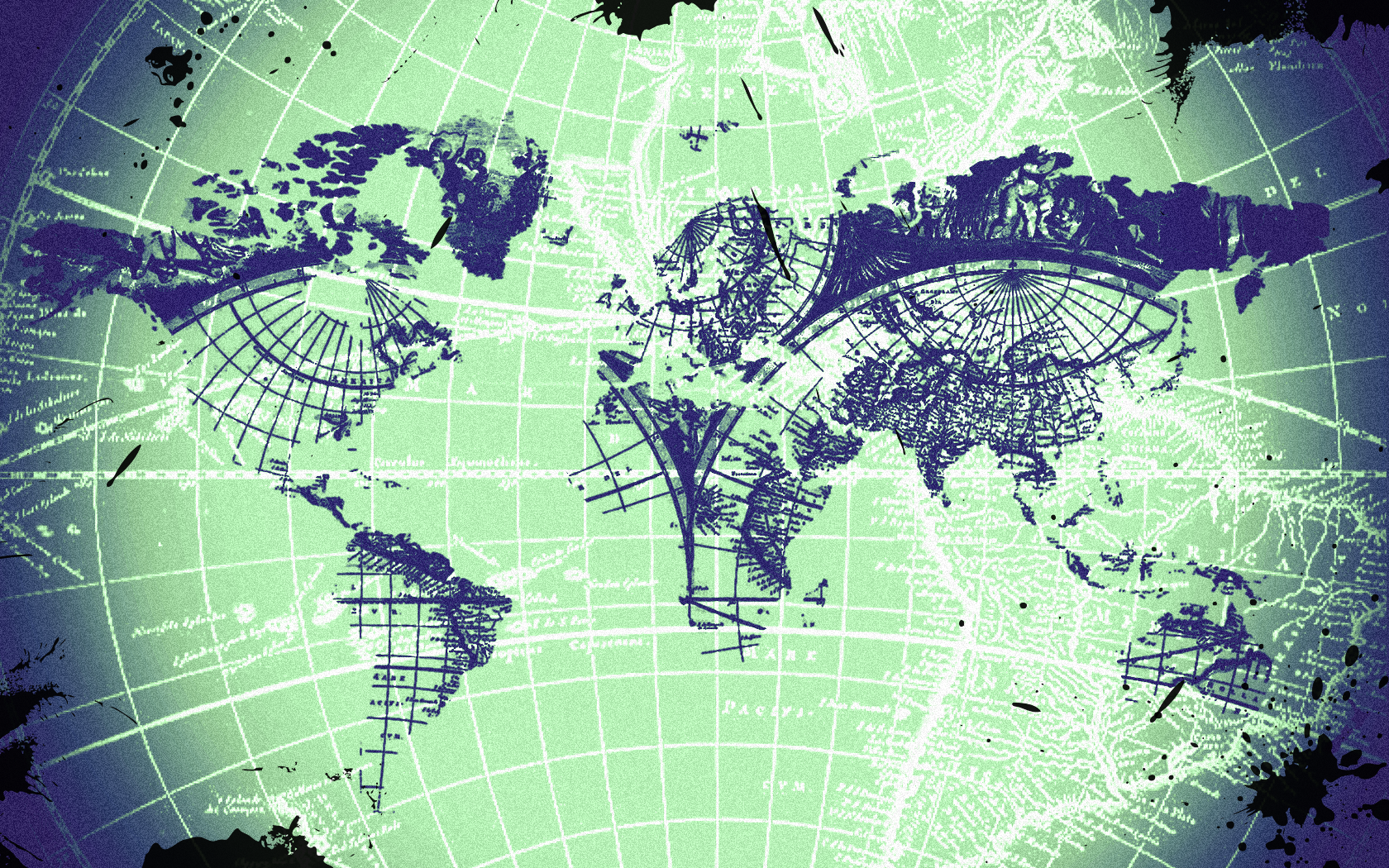
Mapmaker Wallpaper
By
Uwwmatt
Watch
Published:
Nov 13, 2008
10
Favourites
4
Comments
1.4K
Views
Description
My cousin, a geographer, asked me to make him a wallpaper and this was the result.
Let me know what you think guys think.
-Some brushes and shapes were created by other deviant artists.
Image size
1680x1050px 4.08 MB
© 2008 - 2024
Uwwmatt
Comments
4
Join the community
to add your comment. Already a deviant?
Log In
bufonrapero
Dec 7, 2009
Awesome man!!
Reply
Load more